Converting space for cars into space for people can transform New York City.
Our city faces a budget shortfall, a crisis of racial injustice, rising inequality and traffic violence, the loss of millions of jobs and small businesses, and the ongoing threat of climate change. Our recovery can begin, in part, by reimagining our largest public asset — New York City’s 6,300 miles of streets and three million free parking spaces — in support of the needs of all New Yorkers.
Transportation Alternatives and a coalition of more than 190 labor, economic, educational, environmental, disability rights, and public health organizations challenge New York City’s next leaders to convert 25 percent of car space into space for people by 2025.
In doing so, a dangerous and congested street can become a safe and efficient street. A street that divides a neighborhood can become a place to connect. A street used for storing cars can instead become a place for communities to sit, meet, and gather.
Transportation Alternatives presents a new vision for our streets - where people, not cars are prioritized. Here we present five types of streets, which together represent the vast majority of streets across New York City, as candidates for immediate transformation, These include:
For each location, we share a vision of what the conversion of car space could look like and what other kinds of uses — from community building to public transit — that street could offer. The renderings share treatments, approaches, and possibilities that are immediately applicable to thousands of similar streets across the city.
The Problem
Arterial streets are long and wide roads that carry large amounts of vehicular traffic through neighborhoods. These are the most dangerous and congested types of streets. While only 15 percent of New York City streets are arterials, they are the site of 60 percent of pedestrian fatalities; per mile, arterial streets are 8.5 times more deadly for pedestrians than non-arterial streets. And arterials are growing more dangerous: traffic fatalities have been rising nationwide, and even though only four percent of America’s roads are arterials, they are the site of most of the rise in traffic fatalities. Arterial streets prioritize the movement of car traffic over the safety or efficiency of people walking, biking, or riding the bus.
On Staten Island, Richmond Avenue at Arthur Kill Road is a massive crossroad of a five-lane arterial street intersecting a six-lane arterial street. Adjacent to a bus station hosting seven local and 12 express bus routes, a large public park, and a shopping mall, there is no shortage of multimodal traffic here. Approximately 30,000 daily bus riders pass through this intersection, and they often experience delays: buses are late as often as 43 percent of the time. Staten Island residents who rely on public transportation have the longest commutes of anyone in New York City, spending an average 69 minutes each way in transit. Moreover, 48% of Staten Island voters have been injured in a car crash and 88% know someone injured or killed in a car crash.
The Solution
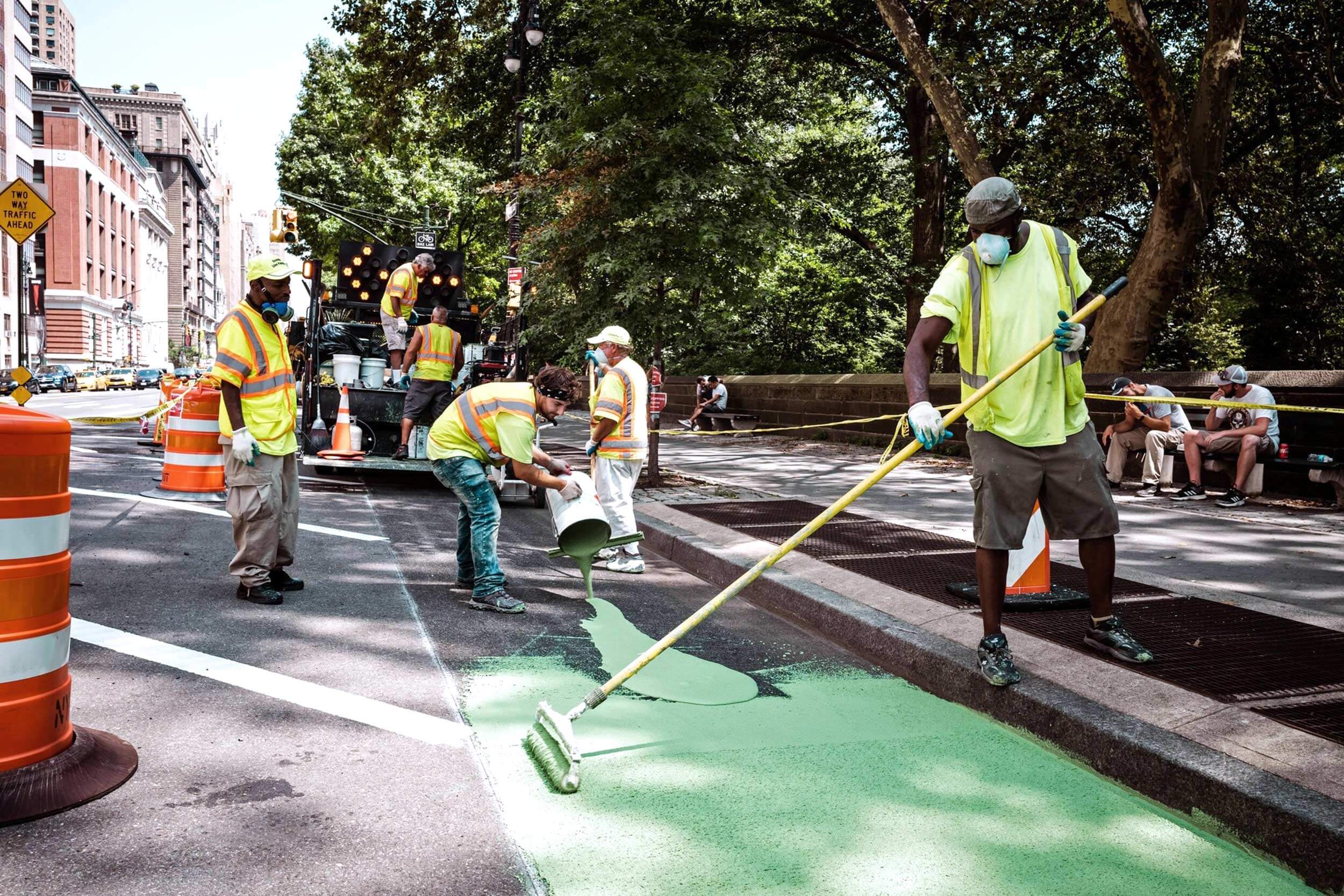
Fixing arterial streets requires prioritizing the most efficient modes of transportation and deprioritizing the most harmful. Wide sidewalks, protected bike lanes, and protected bus lanes can move far more people per hour than car lanes while reducing pollution. Daylighting, high visibility crosswalks, and curb extensions will help to further improve public safety and ensure that cars take turns at a pedestrian-safe pace. Adding bike parking will make multimodal transportation possible.
There is ample evidence that these solutions would have a dramatic effect on the intersection and surrounding community. After car driving lanes were converted into bike and bus lanes on First and Second avenues in Manhattan, commercial vacancies fell by 47 percent, and injurious crashes declined by 37 percent. Converting car lanes into protected bus lanes on the M60 bus line in Manhattan reduced travel times by 36 percent, with no increase in congestion for private car drivers. Installing a similar bus lane on East 161 Street in the Bronx improved bus speeds by 40 percent.
Arterial Streets Ripe for Transformation in Other Boroughs
The Problem
Commerce streets are the central retail corridors in a neighborhood. These streets are often plagued by double parking and delivery chaos, endangering potential customers, employees, and residents. While a concentration of local businesses should encourage local commerce, customers are often driven away by a lack of multimodal access to the street and unsafe crossing, while deliveries are made difficult by lack of dedicated loading zones. As pedestrians have been found to spend up to 65 percent more than drivers, prioritizing foot traffic in commercial corridors should be a clear and obvious goal. New Yorkers are significantly more likely to walk when the purpose of their trip is shopping, eating, socializing, or recreation.
In Manhattan, Broadway at East 17th Street is a high-density central shopping and transit corridor with heavy traffic of every mode. Some 35,000 people pass through on foot every hour, with foot traffic up 17 percent in the past two years and Citi Bike ridership up 94 percent over the same period. Within a half-mile, there are 80 bus and subway routes. More than 34,000 people live within a quarter-mile of this intersection, and those residents are significantly more likely than other New Yorkers to walk or bike to work and less likely to own a car. Local residents also have smaller apartments than the average New Yorker and are less likely to have access to private outdoor space, putting public space and bike parking at a premium for the neighborhood. Another 141,000 people work in the area, and those jobs are majority-independent and locally-owned retail, accommodation, and food service, and thus reliant on local commerce. Broadway is designated as a Vision Zero Priority Corridor by the City, meaning it is one of the most dangerous streets in New York City, with a high rate of deadly and injurious traffic crashes. Children who live nearby are more likely than other New York children to visit the emergency room due to asthma, and outdoor air quality due to cars and trucks is worse there than the rest of Manhattan or New York City as a whole.
The Solution
Improving commerce streets means creating spaces that facilitate spending. Converting car driving and parking lanes into uses like secure bike parking, protected bike lanes, and car-free public plazas will increase local spending and decrease retail vacancies. Fully car-free streets with adjacent loading and unloading zones for deliveries, pick-up and drop-off zones for people arriving by car, and demand-based paid parking will discourage unnecessary driving, making driving easier for people who need to, and ensure that pedestrians and cyclists are safe. Public restrooms, trees, benches, street vendors, flexible space for public programming, and on-street retail and dining will encourage potential customers to stay.
There is ample evidence that these solutions would have a positive effect on commerce, public health, and safety on this street. Reducing car access to Union Square North in Manhattan reduced speeding by 16 percent, injurious crashes by more than a quarter, and commercial vacancies by nearly half. Converting car space into car-free pedestrian plazas in Times Square reduced nitrogen oxide pollution, which can cause asthma and other respiratory issues, by 63 percent and nitrogen dioxide pollution by 41 percent. Converting car parking into public seating to Pearl Street in Manhattan added 100 customers a day per parking spot and produced a 14 percent increase in sales. In fact, replacing one car parking spot with bike parking brings 3.6 times more spending at nearby businesses. In a poll of New York City voters, even when confronted with the fact that each would remove parking or driving lanes, 63 percent supported expanding open streets in their neighborhoods; 75 percent the addition of places to sit, like benches; 88 percent the addition of trees and greenery; and 58 percent support wider sidewalks.
Commerce Streets Ripe for Transformation in Other Boroughs
The Problem
Residential streets are low-traffic through-streets surrounded largely by housing and used primarily for car storage. Wide roadbed designs and less congestion mean that speeding is common on these streets, and narrow sidewalks, parking, and the piling of residential trash on the sidewalk often mean that residents have limited access to sidewalk space and no control over the street space outside their front doors. Residential streets have the most fatalities per vehicle mile travelled, and a crash rate 2.7 times higher than highways. One in four children killed in crashes in New York City are killed within two blocks of their home.
In Queens, 58th Avenue at Junction Boulevard is a wide residential street adjacent to one of New York City’s most dangerous arterials. The neighborhood is majority Asian, Black, and Latino, and is significantly more diverse than New York City as a whole. Residents there are less likely to speak English at home and have longer commutes than most New Yorkers. Despite the amount of space on the street devoted to parking, residents within a quarter-mile of this street are less likely to drive or own a car and more likely to commute via a sustainable mode of transportation (biking, walking, or public transit) than the city as a whole. More children live here, there are more single parent homes, and residences that may be considered “overcrowded” are 146 percent more common here than elsewhere in New York. There are significantly fewer residences with outdoor space and significantly fewer playgrounds per 10,000 children than in Manhattan. More pedestrians are hospitalized in this neighborhood than in the rest of Queens, and more than 440 people have been injured within a quarter-mile of the intersection in the last five years.
The Solution
Fixing residential streets means giving people space outside their front door. Converting space currently used for car storage into dynamic space that serves the community can create new public space where it is needed most. Building on-street trash bins can free up sidewalks and reduce the presence of vermin. On-street short term and long term secure bike parking can free up space in overcrowded homes in a neighborhood where many rely on bicycles. Narrowing the street will reduce speeding and indicate to drivers coming off nearby arterials that this is a residential street. This will also free up space for wider sidewalks, allowing for more trees, biowales, benches, and parklets.
There is a wealth of evidence that these solutions will be popular and improve the quality of life for residents on this block. Reclaiming an average of 2 parking spaces per block could free up over 12,000 tons of waste produced every day off our crowded sidewalks. This would give more space for pedestrians, unclutter our public space, and minimize time spent for sanitation workers, therefore reducing noise, pollution, and time blocking traffic. One tree can remove the equivalent of 11,000 miles of car emissions from the atmosphere every year and reduce air temperatures by nine degrees on the hottest summer days. The current tree cover in New York City conserves $84 million in energy costs and the average tree cover citywide or borough-wide is half as dense as here.
Residential Streets Ripe for Transformation in Other Boroughs
Commonwealth Avenue at Soundview Avenue, Bronx 97th Street at 4th Avenue, Brooklyn, Brooklyn West 148th Street at Broadway, Manhattan Laurel Avenue at Targee Street, Staten Island
The Problem
School streets are streets adjacent to schools that host the arrival and departure of large numbers of children, parents, teachers and school staff every weekday. School streets may have a lot of through-traffic or very little, but in either case, are also used for parking and car-based drop-off and pick-up. Citywide, more than 75 percent of students walk, bike, or take the bus or subway to school. Most New York City schools lack playspace and have no control over the public space outside their school doors. And school streets can be dangerous: in New York City, neighborhoods with a greater number of schools have a higher likelihood of traffic crashes.
In Brooklyn, East 17th Street at Beverly Road is a school street, home to P.S. 245, which hosts one of the largest student bodies in New York State. This school is located between two arterial streets with a high volume of car traffic and lacks outdoor space for children to play. Students at P.S. 245 are 97 percent Black or Latino, 94 percent qualify for free or reduced-price lunch, 27 percent have disabilities, and 10 percent of the student population is unhoused. The neighborhood surrounding the school ranks 50th out of 54 neighborhoods in terms of open space accessibility, has less than half the number of playgrounds as the borough on average, the fourth fewest playgrounds of any neighborhood in the city, and is ranked 14th highest in the City of New York’s Climate Risk calculator. There are significantly fewer homes in the neighborhood with outdoor space compared to the citywide average. Traffic injuries are common within a quarter-mile of the school, which is in a Vision Zero Priority Area, meaning streets in the neighborhood are some of the most dangerous in New York City, with a high rate of deadly and injurious traffic crashes. In recent years, traffic injuries in the neighborhood grew at twice the citywide rate.
The Solution
Fixing school streets requires prioritizing the health, safety, wellbeing, and happiness of children, parents, teachers and school staff on the block where they go to school. Shutting the majority of the streets outside schools to car traffic with permanent retractable bollards will calm local traffic, reduce traffic noise filtering into classrooms, make walking and biking to school safer, and allow for a safe and controlled drop-off and pick-up zones and the installation of bike parking. A full street closure to cars will also make room for a multipurpose educational and recreational space with active play spaces, teaching gardens, outdoor lunchrooms, and outdoor classrooms, as well as greening elements like bioswales, trees, and benches for waiting parents. It will also significantly reduce childrens’ exposure to air pollution and asthma incidence. Where before, this was space that posed a risk to children, converting car space into space for people creates a place where children can expand their minds and stretch their legs.
Evidence shows that these solutions will not only change outcomes for school children, but that they are sorely needed. Black, Asian, and Latino people in the U.S. are as much as 52 percent more likely to live in neighborhoods prone to heat island effects. And elevated mortality rates track highest in low-income community districts, Black neighborhoods, and areas with the highest percentage of roadway and lowest percentage of greenspace. But one street tree can remove 26 pounds of carbon dioxide from the atmosphere a year, the equivalent of 11,000 miles of car emissions, as well as lower the air temperature, provide wildlife habitat, and intercept an average of 1,525 gallons of stormwater. Similar school-adjacent street closures in London reduced nitrogen dioxide by up to 23 percent during morning drop off and resulted in an 18 percent reduction in parents choosing to drive to school. .
School Streets Ripe for Transformation in Other Boroughs
The Problem
Transit streets host underground or elevated subway stations or other public transportation hubs and typically intersect with one or more bus routes. Along with foot traffic related to public transit, transit streets also carry a high amount of through-traffic and parking. These are often chaotic streets full of conflicting demands where curb access is at a premium. Transit streets often create a dangerous and unpleasant environment for people on foot or bike, a high rate of congestion, and an inequitable situation for bus riders, who are often stuck en-masse in traffic behind cars moving only a few people.
In the Bronx, Westchester Avenue at Prospect Avenue is a complex six-way intersection and the location of an elevated 2 train and 5 train station and bus stops for the Bx4, Bx4A, Bx17, and Bx46. There are more than 4 million annual subway trips from this station, and more than 97 percent of transit riders walk to this station. Despite all that foot traffic, sidewalks here are as narrow as 2.3 feet. Residents of this neighborhood have a 10 percent longer commute than the average New Yorker and are less likely to drive to work, significantly less likely to own a car, and significantly more likely to take public transportation.
The neighborhood is predominantly Latino and Black, and the majority of residents do not speak English at home. The mean household income here is less than half the city average, and more than twice as many people qualify for public assistance. Ambulatory disabilities are twice as high as the city average. Air quality is significantly worse here than elsewhere in the Bronx or the city as a whole, and child and adult asthma-related emergency room visits and hospitalizations are twice as high. More than 420 people have been injured in crashes within a quarter-mile of the intersection in the past five years, including 20 crashes at the intersection itself. The number of pedestrian injury-related hospitalizations is 68 percent higher than the city at large. There is a significant climate change risk herewith the highest possible surface temperature rating and the lowest possible vegetation cover rating.
The Solution
Fixing a transit street requires minimizing conflict on the street by prioritizing the forms of transportation that move the most people. Reducing the space devoted to cars will expedite travel for bus riders and make room for wider sidewalks and bike parking for people walking or biking to the bus, subway, or ferry. This will also discourage driving, reducing crashes and improving air quality and helping people with asthma breathe easier. By converting car space into space for benches, public restrooms, trees, bike parking, and food vendors, the trip to the bus, subway, or ferry can become a functional and social destination, allowing commutes to become multimodal and commuters to run errands or see their neighbors as part of their everyday routines.
A dedicated bus lane can move as many as eight times more people than mixed traffic with buses, and 13 times more people than a car lane. Moving more people, instead of vehicles, means shorter commutes and more time with family, more reliable transportation for hourly wage workers, and cleaner air from less vehicle exhaust. Access to reliable and diverse transportation options is the number one predictor of upward mobility. Today over one million New Yorkers travel more than 60 minutes each way to work, two out three of which earn less than $35,000 per year. Non-white New Yorkers are more likely to have longer commute times, while white New Yorkers have below-average commute times.
Transit riders in the Bronx rely on multiple routes or subway lines to where they need to go, more so than any other borough. Only 26 percent of customers use a single bus route for their journey. Meanwhile, 39 percent of customers transfer to another bus route and 35 percent transfer to the subway, meaning that Transit Streets that focus on transfers and multi-modal options are especially important. So are amenities while transferring or after a long-day of work, such as inviting and plentiful bus shelters and benches, trees to cool and clean the air, bike share and bike parking, space for veggie and food carts to avoid an extra trip and save time, and publicly available bathrooms.
New York City’s buses are the slowest in the nation, and the New Yorkers who could most benefit from time savings, lower cost commutes, and access to more jobs are often relegated to buses trapped in car traffic. The median income of bus riders is substantially lower than those of subway riders or New Yorkers overall, and bus riders are less likely to have a bachelor’s degree, more likely to be single parents, more likely to be foreign-born, more likely to be people of color, and more likely to have children at home. Converting car lanes into protected bus lanes on Fordham Road in the Bronx improved bus speeds by 20 percent, and the same changes to the M60 bus line in Manhattan reduced travel times by 36 percent, with no increase in congestion for private car drivers. And, installing a similar center-lane bus lane on East 161 Street in the Bronx improved bus speeds by 40 percent.
Bus routes at this intersection carry 24,638 riders a day. If all these people drove, it would take up to 41 hours to move by car, but only 3 hours to move them by a dedicated bus lane. A recent poll shows that New York City voters support more dedicated bus lanes even if it means less space for cars by a 58 to 39 margin, with even higher support in the Bronx.
Transit Streets Ripe for Transformation in Other Boroughs